|
THE OLD MOHAWK TURNPIKE
AND THE
MOHAWK VALLEY
~ ~ ~ ~ ~ ~ ~ ~ ~
This book is a historical and descriptive account of the country adjacent to or in sight of the Old Mohawk Turnpike,
running from Schenectady to Rome - the main artery of automobile travel along the Mohawk river and one of the most important links in
the New York to Buffalo highway - the greatest motor car traffic route in the world. The Old Mohawk Turnpike also forms a section of
the Boston to Buffalo road and carries the greater part of New England's automobile travel on this direct highway from Boston to Buffalo
and the west. Both of these great touring routes are only made possible by the Mohawk - Tenonanatche, "the river flowing through the
mountains" - which has cut its way through the Appalachian range and given us the present "water level route" from ocean to lakes.
The New York to Buffalo automobile road forms, in its 448 mile course, the backbone of New York State, and along it
the main events of the historical drama of our commonwealth have occurred. In all periods it presents an unbroken pageant of history
which is colorful, dramatic and enthralling. The historical, industrial and social features of this highroad have furnished the most
important elements in the making of the nation, including, as it does, the world's greatest city in the eastern end of the route. Our
America of today is largely what it is because of this noble highway of human destiny.
~ ~ ~ ~ ~ ~ ~ ~ ~
Following the publication of his "Old Fort Plain and the Middle Mohawk Valley," in 1915, the author began a descriptive
and historical study of the New York-Buffalo highway - the State's great street - and, as a result, produced "The New York to Buffalo
Book," which was published serially in the Fort Plain Standard. It is the intention of the author to give this work book publication.
"The Old Mohawk Turnpike Book" is an amplification of that part of "The New York to Buffalo Book" devoted to the section of the great
highway made world-famous by the residence along this ancient trail of the Mohawk tribe of Iroquois Indians.
This book's first edition was issued largely to supply the demand for such a work on the part of the Mohawk Valley
Historic Association, Inc., an organization with which practically all of the patriotic societies of the valley are affiliated. The
Association was organized at the General Herkimer Homestead on August 6, 1920, which was the 143d anniversary of the Battle of Oriskany,
where Herkimer was mortally wounded. The M. V. H. A., Inc., promises great accomplishment in the field of Mohawk valley historical
publicity and of American patriotic service.
Col. John W. Vrooman of Herkimer, was the founder of the Mohawk Valley Historic Association, and it was due to his
public-spirited enterprise that the author undertook the preparation of this work. Recognition of the assistance received, in this task,
from other persons may be found at the end of the book.
Obviously it is impossible, within the limits of this work, to give more than a condensed historical and descriptive
account of the Mohawk river country, traversed by the Old Mohawk Turnpike on the hundred miles of its route. At the time of the
compilation of the book, only the U.S. Census statistics of 1919 and the New York State Department of Labor statistics of 1912 and 1913
were available with reference to figures regarding the valley's manufactures and industries. Revision of these statistics is planned
for later editions.
~ ~ ~ ~ ~ ~ ~ ~ ~
While this issue gives only the westward Turnpike route from Schenectady to Rome, it is probable that there will be
a future publication arranged so that the route will be described from west to east - from Rome to Schenectady - for the
convenience of the eastward-bound tourist. It is entirely possible to read this present book backwards, and at least, the Summary
should be so read by the traveler going east through the Mohawk valley. The present edition, with its westward description, follows
the proper valley historical sequence.
"The Old Mohawk Turnpike Book" makes a wide and popular appeal. In addition to the 500,000 residents of the six
Mohawk valley counties of Schenectady, Schoharie, Montgomery, Fulton, Herkimer and Oneida, there are 250,000 dwellers in the Albany-Troy
group of cities, at the mouth of the Mohawk and the terminals of its highways and the New York Central Mohawk division, who are closely
identified with the past and present of the Mohawk valley. To these three-quarters of a million Americans may be added another quarter
of a million one-time residents of the area mentioned, who are now dwellers elsewhere, but who still retain an interest in the old
homeland. This 'local" reading public of one million people, receives large additions from the great number of tourists who have
learned to know and love the Mohawk valley, from the people resident along the entire New York to Buffalo Highway and also the
considerable nation-wide class which finds an interest in its great historical, commercial and scenic importance.
The author advises reading the Summary prior to the body of this book, thus getting a birdseye valley view, before a
closer examination. This Summary affords a quick and ready reference feature of this work, useful while riding on the Turnpike and its
detours, while the body of the work is for reference and reading when the tourist is at a stop for the night or while visiting historic
points and buildings, and also as a standard reference work for the Mohawk valley resident. For a more complete and comprehensive
historical and descriptive account of the Mohawk river and valley, see the author's "Old Fort Plain and the Middle Mohawk Valley."
The historical and pictorial points along the Mohawk Turnpike are taken as they come. However, in making this book,
some attention has been given to the fact that motorists seem more interested in country than in city features and attractions.
~ ~ ~ ~ ~ ~ ~ ~ ~
The automobile's influence, while felt, is not yet thoroughly appraised by those living in the generation of its
marvelous development. It is doing more to make the members of America's great family acquainted with kin and country than any other
existing agency. This book aims to bring to the automobile tourist a brief and intimate knowledge of the story of the Mohawk, as seen
from the Old Mohawk Turnpike. It is self evident that it is to the advantage of the people of the valley to make their homeland as
attractive as possible to the tourist. Automobile camps, countryside inns, boating and bathing places, public golf links and playgrounds
are features worthy of consideration in an age that counts the Turnpike motor car tourists of a season by the hundreds of thousands.
Doubtless eventually the Mohawk Turnpike towns will place attractive signboards at their "gates" giving the town's name
and other brief information. Also all historic sites should be marked by signboards or artistic permanent memorials and guide boards
placed to give full information on all Turnpike subjects for the benefit of motorists.
These town signboards should be placed at railroad stations and Barge canal terminal docks, wherever possible. Each
community should also have all street corners plainly marked, this seemingly unimportant matter being of great importance to visiting
motorists, whose road books frequently refer to streets which are totally unmarked.
The Turnpike and Central railroad and Barge canal afford today a tremendous, but unappreciated, opportunity for
national publicity by means of the erection of artistic sighnboards and the distribution of valley publicity material to motorists
and railroad travelers. Seldom can tourists get such a "close up" view of a region, as here along the Mohawk, and the first town to
utilize these natural advantages will reap sure, growing and lasting material rewards.
The Mohawk valley is indeed "a land flowing with milk and honey," which only needs proper publicity to become known
to all Americans of Uncle Sam's broad land. The valley as a whole has had but little accurate publicity, which it is the aim of the
Old Mohawk Turnpike Book to supply.
~ ~ ~ ~ ~ ~ ~ ~ ~
The Mohawk river rises at Mohawk Hill in Lewis county, flows 30 miles southward to Rome, where it turns and runs, for
117 miles, generally east by south, making a drop of over 60 feet at Cohoes Falls and entering the Hudson a mile below, opposite Troy.
The Old Mohawk Turnpike closely follows the river over the 95 miles from Schenectady to Rome - the section covered in the following pages.
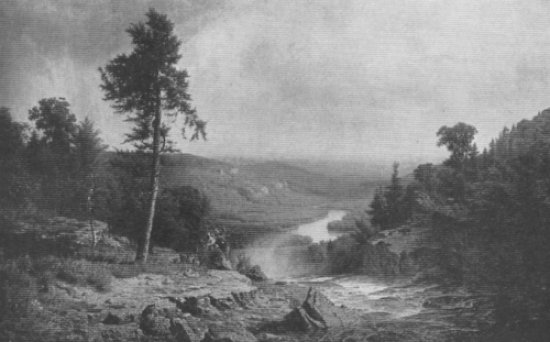
In no other hundred miles automobile tour of America can the motorist see and know so much of interest, within the
limited area of his vision, as here along the Old Mohawk Turnpike. It affords, to the automobilist, an unfolding panorama of unrivaled
pictorial and human interest - a view in brief of America and an outlook upon thrilling chapters of American history.
Steep hills enclose the river flatlands along the Mohawk's 80 mile course from Utica to Schenectady, some of which
rise to heights of over 1,000 feet above the river. On the northern and southern limits of the Mohawk watershed, the highest Mohawk
mountains reach an altitude of 2,500 feet above sea level and over 2,000 feet above the Mohawk river.
The Mohawk Valley is a mountain pass, between the Adirondacks on the north and the Catskills on the south. It is
one of the oldest land regions on the earth's surface because it forms the southern border of the Adirondacks which was one of the first
land areas to rise above the primeval ocean. Geographically the Moahwk Valley is most important and its rocks form a text book of
geology in themselves.
In the long and narrow Mohawk mountain pass, there are five important closely paralleling transportation routes - the
north and south shore Mohawk turnpikes, the New York Central and West Shore railroads and the New York State Barge canal utilizing
largely the river channel. The close contact of these five transit ways permits a more intimate view of the New York to Buffalo line
here in the Mohawk valley than in any other section of this greatest of nation transportation routes. These closely bound valley water
and land lines join the Mohawk river towns in a close community of interests that makes this valley route one of personal regard to the
people of the Old Mohawk Turnpike in whatever section they may be located. It is to foster this Mohawk valley community spirit that the
Mohawk Valley Historic Association was founded, and the aim of this book is to still further stimulate this Mohawk Turnpike neighborhood
feeling.
The total area, of the valley of the Mohawk river, is 3,485 miles, slightly lass than that of the island of Puerto
Rico. The Mohawk watershed is largely embraced in the six Mohawk valley counties of Oneida, Herkimer, Fulton, Montgomery, Schenectady
and Schoharie. These six Mohawk valley counties have an area of 2,860,000 acres, slightly less than one-tenth of that of New York State.
The 1920 population of these Mohawk valley counties was 480,000. In 1920 there were two cities with a population of 100,000, inclusive
of their suburbs - Schenectady in the eastern and Utica in the western Mohawk valley.
~ ~ ~ ~ ~ ~ ~ ~ ~
Agriculturally the Mohawk valley is rich, industrially and commercially it is important. In 1910 there were 18,000
farms, embracing 1,350,000 acres of improved farm land, in the six Mohawk valley counties, annually producing $30,000,000 worth of farm
products, with dairying the principal item and hay, oats, corn, barley and buckwheat, the principal crops in the order named. The 1920
figures were not at hand at the time of publication of this edition.
Industrially the narrow confines of the valley house some of the country's most important manufactures. In the six
Mohawk valley counties, in 1920, there are 1,500 factories, with over 100,000 employes, with knit goods, electrical apparatus, leather
gloves, white goods, rugs and carpets the leading industries, in the order named. In the World war much of the valley's manufacturing
power was devoted to the production of war supplies.
In the important matter of transportation, it is impossible to estimate the enormous amount of passenger and freight
traffic over this national trade route.
The valley's contribution to America's list of inventions is a notable one. It embraces the threshing machine, the
Yale lock, sleeping and palace cars, the air brake, firearms, electrical devices and the construction of the first commercially
practicable typewriter.
~ ~ ~ ~ ~ ~ ~ ~ ~
In pre-glacial times, the upper Mohawk valley formed a broad lake with a great falls, at present Little Falls, and an
outlet into a long lake which lay in the present valley for twenty five miles southward to the present Noses at Sprakers, where its waters
tumbled in a giant cataract to the lower river channel of the far greater Mohawk of that far-distant day.
The glacial and water action, which wore down these two Mohawk uplifts, have combined to make this shut-in valley one
of the most beautiful regions of the earth. Its placid river, rich farmlands and sweeping forest-crowned hills afford a variety of
pleasing pictures as one courses along the Old Mohawk Turnpike. Indeed "Sweet is the vale where the Mohawk gently glides."
Historically the Mohawk valley is one of the most important small defined areas in the United States, for it bore a
vital part in the making of America.
The Mohawk valley is the Gateway to the West and the route along which much of the history of America has been made.
Nature has here created the only low pass through the Applachian mountain chain making possible this great national transportation route
of railroads, highways and waterway.
This is the land of the Mohawks - magic word recalling the power and prowess of those mighty warriors, elder brothers
of the Iroquois confederacy, conquerors and empire builders among the Indians of North Amercia. It is the land of the Hollander and
Palatine pioneers, of Sir William Johnson - greatest of Colonial American nation-makers - land of the patriot hero, General Nicholas
Herkimer, whose little army of Mohawk valley farmers threw back the invaders in the bloody forest of Oriskany and there gained for America
her priceless heritage of liberty.
The history of the Mohawk river is also intimately relted to that of the Hudson-Champlain, St. Lawrence, Mohawk
triangle, both geographicaly and historically. The majority of those vital conflicts, which have made the history and shaped the
destinies of North America, have eventuated along this comparatively small triangle of the land of Uncle Sam - that famous character who
was "born" at Troy opposite the mouth of the Mohawk in 1812, seven miles above Rensselaer, where "Yankee Doodle" was written in 1758.
The history of Albany is closely identified with that of the Mohawk valley. Albany, Kngston and New York - all on the
Hudson river, were founded by the Dutch in 1614 and are today the oldest towns in the thirteen original states of the United States of
America. Only St. Augustine and Santa Fe are older cities located within the present continental limits of the United States. For two
centuries (1614-1814) Albany was the metropolis of the Upper Hudson and the Mohawk valleys.
In 1614, when the first Dutch traders entered the forest covered valley, its river was the seat of the Mohawks - the
most ferocious, and at the same time, the most civilized of all the Indians of the northeast. Their story is interwoven with that of the
settlement here of Hollander, British and German pioneers, and the tales of their bloody struggles to defend their valley homes.
In the century of warfare between France and England for North American supremacy, the settlers and the native
Mohawks, living along the river, formed a bulwark of Colonial defense against attack from Canada, although massacre and destruction were
often the lot of both white pioneers and savage warriors. Over this Mohawk military road - the "King's Highway" - an army of American
militiamen, British regulars and Mohawk warriors marched to the final conquest of French Canada at the city of Montreal - an epochal
chapter in the story of the world, one which guaranteed the world-supremacy of the English-speaking peoples.
In the Revolution, the valley men-at-arms held the breach again and again against savage assault, and, at the close
of those long and bloody years of border warfare the Mohawk country was the most ravaged and desolated region in the victorious United
States.
From the days of French and Indian raiders, through the War for Independence, the War of 1812, the Civil war and
America's years in the World war for civilization - through all these centuries - American armies have marched or ridden to battle and
victory over this same great warpath.
Following the vivid years of the Revolution, a great tide of westward emigration flowed over this national highway,
moving to the settlement of the Great Lakes and Mississippi valley regions. In this historic migration, much of the Mohawk river region
was settled. During the coincident period of national expansion, highways, bridges, waterways and railways were successively made through
the valley of the Mohawk. In sequence there followed developing activity in manufactures and commerce, with consequent town buiilding,
while agriculture increased with the growing population and enlarged transportation facilities. In late years, the canalization of the
Mohawk river has added enormously to the capacity of the Mohawk valley traffic route. In America's social, intellectual, political,
agricultural and industrial development the Mohawk valley has played its due part.
And now let is give a thought to the memory of the Mohawk river pioneers who created the valley as we see it today.
Their records, in their old homes, farms, churches, mill sites and the battlefields on which they fought, are visible along the Old Mohawk
Turnpike, to all who care to see and know them.
Remember those brave Americans who founded an empire and here, beside the Mohawk, reared their edifice of liberty
and civilization. It was not magic which brought ths once vast savage forest country to its present state of cultivation and
civilization - it was the hard work of human hands - the strong hands of the pioneer, his children and his children's children.
Let us consider these men and women of other days - these trail blazers of civilization - that we may measure up to
them in manhood and womanhood.
Let us honor the brave men and women of old and give heed to their story as it is told in the following pages.
NELSON GREENE
Fort Plain, N.Y., November 7, 1923.
NOTE: - The word "turnpike," as in the Old Mohawk Turnpike, comes from the use of a pike or pole balanced and swinging
on a post and placed in the center of the early turnpikes. It was used as a toll gate and barred the road until the traveler paid his
toll when the pike was turned parallel with the road and the toll-payer passed through. The early turnpikes were thus toll roads and
therefore comparatively good highways. Toll gates were used on the Old Mohawk Turnpike - the "turnpike" being an earlier thing.
NOTE, FT. STANWIX: - Since writing the Summary and Foreward, the author, after thorough investigation, has adopted
the name of Fort Stanwix for the fortification at Rome from 1758 until 1788, and intermittently some years thereafter. This is just and
also makes an easy differentiation between Fort Stanwix at Rome and Fort Schuyer (of the French war) at Utica.
~ ~ ~ ~ ~ ~ ~ ~ ~
CHIEF POINTS OF INTEREST ON
THE OLD MOHAWK TURNPIKE
(With Mileage Schenectady to Rome)
SCHENECTADY - Schenectady County Historical Society (adm. free). St. George's Church, 1762. Great Western Gateway
Bridge. SCOTIA (1 m.). Glen-Sanders House, 1713. Abraham Glen House, 1730. ROTTERDAM JUNCTION (5 m.). Jan Mabie House, 1670, oldest
in Valley. Jantpoochaberg Mt. (so. shore), 1,400 ft. sea elevation. HOFFMANS FERRY (9 m.). Wolf Hollow. Touareuna Mt., 1,100 ft.
sea el. AMSTERDAM (16 m.). Guy Park, 1766, historical collections (adm. free). FORT JOHNSON (19 m.), 1749. Montgomery Co. His. Soc.
collections (adm. free). Detour at TRIBES HILL (21 m.) to s. side to AURIESVILLE (23 m.) Shrine. Statues of Father Jogues and Tekawitha.
FONDA-FULTONVILLE (27 m.) Butler House (1742). Detour 4 m. n. to Johnstown, Johnson Hall, 1862. Johnstown Historical Society
collections (adm. free). Court House, 1772. Jail, 1772. YOSTS, THE NOSES (33 m.). Big Nose (n. shore), 940 ft. sea el. Little Nose
(s. shore), 740 ft. sea el., cliff, 300 ft. CANAJOHARIE-PALATINE BRIDGE (39 m.). Falls, Gorge, Pothole. Ft. Frey, 1739. Van Alstyne
House, 1749. Detour n. 4 m. Stone Arabia Churches, 1788-1792. FORT PLAIN-NELLISTON (42 m.). Ehle House, 1727-1755. Bleecker House,
1786. Ft. Wagner, 1 m. w., 1750. PALATINE CHURCH (45 m.). w. side Garoga creek, 1770. Gen. Cochran House, 1790. Ft. Klock, 2. m. w.,
1750.. ST. JOHNSVILLE (48 m.). Motorists' rest park. EAST CREEK FALLS (51 m.). East Canada Creek. Indian Castle Church, 2 m. w. s.
shore, 1769. FINK'S BRIDGE (57 m.). FALL HILL, n. s., 1,060 ft. sea el.; s. shore, 860 ft. sea el. Detour GEN. HERKIMER HOME, 1 m. e.,
s. shore, 1764. LITTLE FALLS, (58 m.). Gorge, Potholes. Barge Canal Big Lock (highest in America). Falls, Rollaway cliff, 300 ft.
Half-way N.Y.-Buff. 4. m. w., Mt. Okwari, s. shore, 1,380 ft. sea el. at Jacksonburg. HERKIMER (65 m.) w. side W. Canada creek.
Statues Gen. Herkimer, Gen. Spinner. Mirror Lake. Herkimer County Historical Society collections (adm. free). E. river bridge to
FT. HERKIMER CH., 1767. MOHAWK (66 m.). Shoemaker House (before 1775). ILION (68 m.). Gorge. First commercial typewriter marker, 1873.
FRANKFORT. Gorge. Folts Homestead, 1795. 3 m. w. Dutch Hill, 1,069 ft. sea el. UTICA (80 m.). N.Y. Masonic Home. Frankfort Hill, 1,420
ft. s. shore, sea el. Bell Hill, n. shore, 1,582 ft. sea el., highest river hill. Site Old Fort Schuyler (1758-60). Senator Conkling,
Vice-Prest. Sherman Houses. Statues Seymour, Sherman, Proctor, Gen. Steuben. Parks. Oneida County Historical Society collections
(adm. free). WHITESBORO (84 m.). 1784 Settlement Marker. ORISKANY (87 m.). Order Eastern Star Home. ORISKANY BATTLEFIELD MONUMENT
(89 m.), marks decisive Revolutionary American victory of Oriskany, Aug. 6, 1777. ROME (95 m.). Rome Club on site Ft. Stanwix (1758-1788).
First unfurling American battleflag, Aug. 3, 1777; sortie, Aug. 6, 1777.
|